Dungarvan is a coastal town and harbour in County Waterford, on the south-east coast of Ireland. Prior to the merger of Waterford County Council with Waterford City Council in 2014, Dungarvan was the county town and administrative centre of County Waterford. Waterford City and County Council retains administrative offices in the town. The town’s Irish name means “Garbhann’s fort”, referring to Saint Garbhann who founded a church there in the seventh century. The town lies on the N25 road (European route E30), which connects Cork, Waterford and Rosslare Europort.
Location and access
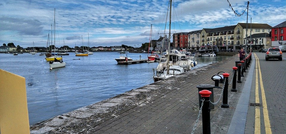
Dungarvan is situated at the mouth of the Colligan River, which divides the town into two parishes – that of Dungarvan to the west, and that of Abbeyside to the east -, these being connected in three places by a causeway and single-span bridge built by the Dukes of Devonshire starting in 1801; by an old railway bridge; and by a ring-road causeway and bridge.
History
Dungarvan Castle, commissioned in the late 12th or early 13th century by King John of England, stands by the harbour. The original structure of the castle, including a shell keep of a type atypical in Ireland, dates to c.1209.[6]
The town of Dungarvan was incorporated in the 15th century, was represented by two members in the Irish Parliament until the Act of Union in 1801, and returned one member to the Westminster Parliament until 1885. Unlike nearby Waterford and Duncannon, Dungarvan surrendered without a siege in the Cromwellian conquest of Ireland (1649–53).
The remains of a woolly mammoth were discovered in the town in 1859 by postmaster and amateur antiquarian Edward Brenan.
The 1921 Burgery ambush, an incident in the Irish War of Independence, took place near the town.
Irish language
Approximately 3% of the town’s population, or 242 persons are daily Irish speakers, outside of the education system. (Census 2011). Education through the medium of Irish is available at pre-school and primary level in the town in the local Gaelscoil, Scoil Garbhán. The Irish Language Officer of Waterford City and County Council is based in Dungarvan.
There are a range of activities and projects undertaken to strengthen the Irish language in the town. An Irish in Business award was established in 2009 to recognise businesses in Dungarvan and West Waterford who work to promote the Irish language.
The town is home to an office of Glór na nGael, a national body that promotes the Irish language in three areas, the language in the family, in Business and enterprise, and community development. The Dungarvan office is responsible for Glór na nGael’s work across South Leinster and most of Munster.
There is also contact between the town and the nearby Gaeltacht area of Ring, County Waterford and Old Parish which make up Gaeltacht na nDéise. Dungarvan was identified as a potential Gaeltacht Service Town under the Gaeltacht Act 2012. Under the Gaeltacht Act 2012, Gaeltacht Service Towns are defined as those towns situated in or adjacent to Gaeltacht Language Planning Areas and which have a role in providing public services, recreational, social and commercial facilities for those areas.
Geography
Dungarvan is situated at the mouth of the Colligan River. Dungarvan Harbour as such is formed by The Quay (on the town side) and The Causeway. A single-span bridge was built in the late 18th century by Lord Devonshire to link Dungarvan with Abbeyside and indeed Waterford via said causeway. Outside the harbour, a 3-kilometre (1.9 mi) sandbar, “The Cunnigar” (Irish An Coinigéar) defines the western limit of the 4-kilometre (2.5 mi) wide Dungarvan Bay. The Cunnigar encloses the estuary of the River Brickey which flows out to sea at Abbeyside without actually joining the Colligan. The two estuaries are separated by “The Point”.
Religion
A friary in Abbeyside, founded by Augustinians in the 13th century, is partially incorporated with the structure of a 20th-century Roman Catholic church. One of the most significant colleges in the town was also founded by these Augustinians whose order survives and maintains an Augustinian church nearer to Main Street.
Toponymy
In everyday local usage, “Dungarvan” is taken to refer to the western, more commercial half of the town, where the administrative buildings and shopping areas are situated.