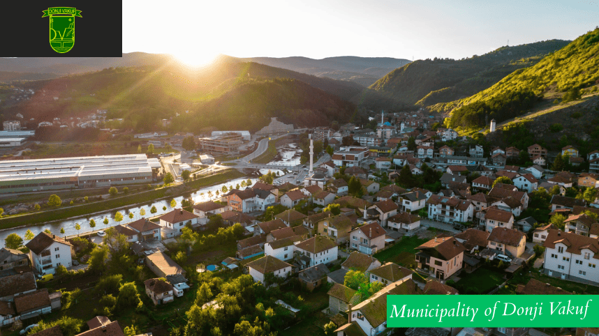
The Municipality of Donji Vakuf is located in the upper course of the Vrbas River, in the central part of Bosnia and Herzegovina and the Federation of Bosnia and Herzegovina, and it belongs to the Central Bosnia Canton.
It lies at the crossroads of the main roads Travnik – Donji Vakuf – Jajce and Travnik – Donji Vakuf – Bugojno (main roads M-5 and M-16). The length of its municipal border is 93 kilometers, and it borders the municipalities of Jajce, Šipovo, Kupres, Novi Travnik, and Travnik.
The area of the Municipality of Donji Vakuf is 323.7 square kilometers. It is divided into 13 local communities with 64 populated settlements.
According to the 1991 census, Donji Vakuf had 24,544 inhabitants, of which 13,509 (or 55%) were Bosniaks, 9,533 (or 39%) Serbs, 593 (or 2.7%) Croats, and 820 (3.3%) Others. The war brought significant demographic changes compared to the last census. Current population estimates indicate that Donji Vakuf has 14,167 inhabitants, of which 14,000 (or 98.9%) are Bosniaks, 84 (or 0.6%) Croats, 79 (or 0.5%) Serbs, and 4 Others.
Relief of the Municipality of Donji Vakuf
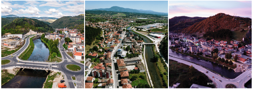
Most of the municipal territory is distinctly hilly and mountainous. The lowland area (450–550 m above sea level) covers about 7% of the territory, while the hilly-mountainous area (550–1,000 m above sea level) makes up about 65% of the territory. Within the municipality and its surroundings, several mountains rise above 1,000 meters, including Komar, Radalj, Kalin, Radovan, Vranica, Crni Vrh, Velika Šuljaga, Velika Plazenica, Čučkovine, Dekale, Kriva Jelika, and Ravna Gora.
Hydrography
The municipality is entirely part of the Vrbas River basin, which divides its territory into two almost equal parts. Perpendicular to the Vrbas flow several tributaries: Ćehajićka River, Volušnica stream, Prusačka River, Oboračka River, Semešnica River, Sandžački stream, Babin stream, and Sokolinski stream, along with their tributaries. All rivers and streams in the municipality that flow into the Vrbas run through narrow and steep valleys, characterized by low permeability of the surface terrain. Their riverbeds are shallow and unregulated, so during periods of heavy rainfall and rapid snowmelt, water frequently overflows its banks.
Climate and Seismic Conditions
The climate of the Municipality of Donji Vakuf is continental-mountainous. During the year, temperatures range from -25 °C to +35 °C, with clearly marked seasons. The heaviest rainfall occurs in spring and autumn, with official data indicating precipitation between 900 and 950 liters per square meter. Heavy snowfall occurs in the winter months, forming a snow cover of 30 to 50 cm, while in areas above 1,000 meters snowdrifts can reach up to 200 cm and remain for up to three months.
The Municipality of Donji Vakuf is situated in a seismically active area of the Mediterranean seismic zone and belongs to the seventh category of earthquake risk. In the past, no earthquakes stronger than six degrees on the Mercalli scale have been recorded in this area.
History of the Municipality of Donji Vakuf
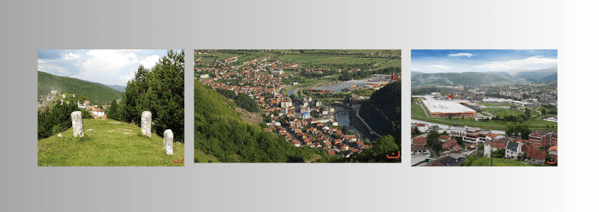
In the surroundings of Donji Vakuf there are 16 necropolises of medieval stećci tombstones, remains of a Gothic basilica in Oborci, and the Turbe of Torlak Alija in Torlakovac. The greatest concentration of cultural and historical monuments is found in Prusac (4 km from Donji Vakuf), with landmarks such as the fortress “Stari grad” (started by the Venetians and completed by the Ottomans), a clock tower, the turbe of Hasan Kafi Efendi, the turbe of Ajvaz Dede, and Ajvaz Dede’s rock “Ajvatovica,” known as the “little Kaaba” and today the largest Muslim gathering place in Europe, as well as the biggest assembly of Bosniaks.
Brief Overview of Donji Vakuf
In the Middle Ages, the area belonged to the parish of Uskoplje. The exact year of the town’s foundation is unknown, but records show that by 1530 it was referred to as Donji Novi. According to historian Nasuf Fazlagić, the town was founded by Ibrahim-beg Malkočevic, son of Malkoč-beg, a notable Ottoman governor. In 1574 he built the central mosque, later mentioned by the traveler Evliya Çelebi. At that time the settlement was known as Novosel. A decree of Sultan Murad III from 1590 granted the settlement tax exemptions due to its strategic and communication importance, giving it the status of a kasaba (small town).
Name and Development
The Ottomans originally called the town Fakvi-ziv, later Donji Vakuf. By then it had 161 houses and was inhabited mostly by craftsmen, merchants, and imperial officials, with 14 soldiers stationed there. During Ottoman rule, no houses were built on the left bank of the Vrbas, and the settlement on the right bank grew slowly.
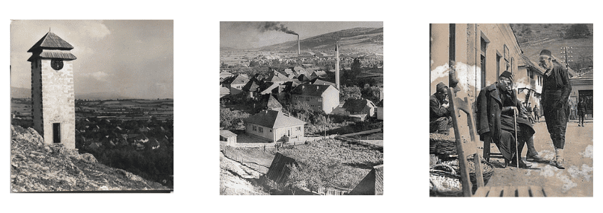
With the Austro-Hungarian occupation, the small town had about 2,000 inhabitants. Its rich forests attracted Viennese industrialists, leading to the construction of narrow-gauge railways Donji Vakuf–Jajce and Donji Vakuf–Bugojno, as well as roads along the Vrbas valley. In 1901, the first water-powered sawmill was built on the Semešnica River, owned by Hugo Feldbauer, and the Vrbas was bridged (Filbar’s Bridge).
At the beginning of the 20th century, Donji Vakuf had 2,329 inhabitants (more than neighboring Bugojno). It hosted a district office, gendarmerie station, nine mosques, four mektebs, a public primary school, Orthodox churches and schools, and railway stations. Industry began with a gypsum factory, carpet weaving workshops, and a few small businesses. About 350 people were employed in trade, crafts, hospitality, and industry, while the rest of the population was engaged in agriculture.
To learn more about local administration, services, and community updates, visit the official website of the Municipality of Donji Vakuf.