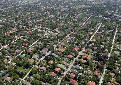
Érd is a town in Pest County, Budapest metropolitan area, Hungary.
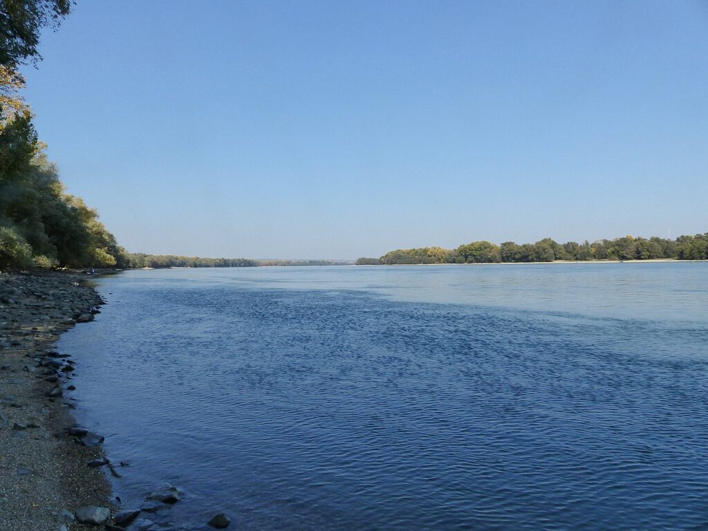
The settlement on the banks of the Danube is located east of Tárnok and west of Diósd in the area of the Tétény Plateau and the Érdi-roofed hills. Érdliget and Ófalu are located in the former floodplain of the Danube . During the Kádár era , the city was divided into districts (this was a great help to the population, especially before the introduction of postal codes ), but today the local people recognize the names of the districts where they go (despite the size of today’s districts. differs from the change of regime in several places ).
Sights
Cuckoo Mountain
Mount Kakukk is one of the few areas in the country where the loess steppe described in the introduction has literally survived in the form of a forest-grass mosaic. It is important to emphasize this because in the Hungarian loess lands there is often only one woodless component of the loess steppe, the loess steppe grass or the loess pasture. The Cuckoo Hill lösznövényzet not isolated area, but érd- Százhalombatta Rampart Mountain more-valuable remains of lösznövényzet – fortification , tumuli, high bank , Százhalombattabrick factory-loess valley system and brick factory slopes – it is connected through the meadows and the small plots with abandoned and partially regenerated loess vegetation. The key to the survival of vegetation is to have this connection through ecological corridors in the future. Therefore, it would also be necessary to provide uniform protection for the loess vegetation patches of Sánc Hill that are not currently protected or have a different level of protection. Kakukk Hill was declared the 200th nature reserve in the country in April 2007.
The Érdi High Coast
“The high-Érdi alámosott coast, broken down vertical walls Ófalu respectively. The Danube to. The highest point of the plateau 177 meters Cuckoo Hill Ófalu above, and the 163-meter Rampart Mountain draws attention to itself over the Danube.
In the protection of the high shore walls, the plant species of the eastern steppes and steppes and the Mediterranean plants that immigrated to Hungary from the south after the ice age occur together . “The Érdi High Coast was declared protected in 1985.
Fundoklia Valley
The most beautiful part of Érd-Parkváros in terms of landscape is the karst meadow valley carved into the Sarmatian limestone, the Fundoklia. At the end of 1962, north of the M7 motorway, near the valley head, the Paleolithic settlement of Érd came to the surface “, which is” a mounstérien culture, in a broader sense the world-famous Hungarian site of Neanderthal man’s culture “.
There are about 25 protected plant species in and around the Fundoklia Valley, providing shelter for several protected lizard species and shrike species, but the forest glider also occurs.
The area received local protection in the spring of 1999.
Chimes
It was handed over in 1993, on the 750th anniversary of the first diplomatic mention of Érd. The 12 bells of the chime play 45 melodies.
St. Michael’s Church
The church, rebuilt on 15th-century ruins , was blessed in 1723 . The clock-led tower of the church was built in 1774 by the generosity of the benefactor János Illésházy . The church tower is divided into three parts by two belt ledges, and its decoration is served by pilasters with ion column heads.
The floor plane of the nave is about 2 m deeper than the entrance level of the tower. A flight of stairs leads down to the nave.
To this day, the braid main altar, the Baroque side altars and the stone-carved baptistery have been preserved from the old furnishings of the church.
Minaret
“Along the route of the Roman military road rises a mosque minaret built in the 17th century, reminiscent of the disappeared memory of the Turkish world. The 23 m high Érd minaret stands out among the Turkish towers in Hungary. The stairway is illuminated by slotted openings in the tower wall. “
The floor area of the mosque was 10×11 m. In the 19th century, the dome collapsed as a result of a lightning strike, which was restored in 1971, until then locals also called it a “truncated” minaret.
The monument is owned and managed by the Local Government of Érd, and its opening hours are provided by the Szepes Gyula Cultural Center. Available: May 1 to October 1, daily from 2pm to 6pm except Mondays. Visits at a different time are possible by prior registration at the cultural center. Worn stairs, lack of lighting warns all visitors to be careful. The round balcony cannot accommodate more than 3-5 people at a time.
II. Louis Monument
In 1926, it was erected for the 400th anniversary of the Battle of Mohács. The monument decorated with a lion from Roman times II. King Louis captures the stay of the Hungarians in Érd.
Chapel of St. Sebastian, St. Roch and St. Rosalia
According to a book made by Gyula Kereskényi in 1886, the 18th century baroque chapel was built in 1734 on the occasion of the great plague.
“The square-plan chapel closes with a basket-arched apse. A 1-1 window was placed on the side wall. Its wooden bell tower is decorated with a graceful helmet. The nave and altar of the chapel . ”
Hungarian Geographical Museum
In the center of the city is a complex of buildings called “the former famous” Pelican “and later the Wimpffen mansion with classicist features.
Next to the busy country road from Buda to Székesfehérvár, the main building of the inn and the separate service building wings (the side wings acting as two stables and the carriage center in the middle) were built between 1820 and 40.
From 1910 for a few years it was inhabited by officers. From 1923, the St. Stephen’s Civil Boys’ School operated in the main building. In 1942, the Village Prefecture moved from Ófalu to the mansion building. At the end of the 19th century, the buildings of Alsó utca and then at the beginning of the 20th century Felső utca, originally a stable, were transformed into a civil residential building. The main building served as a Council House until 1979, and after its continuous relocation, “From 1983, the Hungarian Geographical Museum found a home within the old walls.”
Dog Castle
The Dog Castle is the oldest 15th century Gothic building in Érd. According to the legend, it was built by Mátyás Hunyadi for his hunting dogs and their caretakers, the dog handlers. Today, only its ruins are visible. It is not known whether it was really built by King Matthias or the Elbenyi brothers.
Pine forest
In Érd-Parkváros, the protected forest can be approached from Borostyán Street in the garden surrounded by a high limestone wall, the planted population of which is dominated by Scots pine (Pinus silvestris). On the highly calcareous, karstic surface, pine also thrives on low-yielding soils.
Beliczay Island
The landscape of the bank covering the eastern borders of Érd, fitting to the Danube, is about 9 km long and 2-3 km wide, covered with low spatial, floodplain sediments from Érd- Ófalu to Háros in a slightly curved shape. Once upon a time, at the end of the Miocene , one of the shallow bays of the Pannonian Sea occupied this area. From this period, sandy, gravelly, clayey sediments also survived on the surface in the vicinity of Diósd. The formation of the Érd-Tétényi Bay is explained by tectonic reasons. The area sank so much at the end of the Pleistocene that the branches of the Danube moved from the east to it.