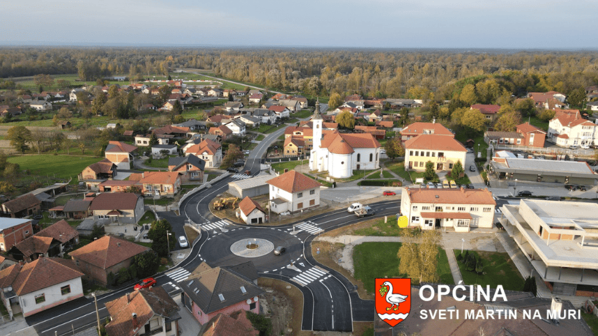
Sveti Martin na Muri is located in a valley, between the last northern hills — the Međimurje hills — towards the River Mura
It is one of the oldest parishes and settlements in this part of Međimurje. It was right here that the famous Roman road from Ptuj to Lendava crossed the River Mura.
It is the northernmost geographical point of the Republic of Croatia. The settlement rises above diluvial terraces, in an important geostrategic position. In this area, the easiest crossing over the River Mura was located — a spot valued since prehistoric times. Within the municipality’s territory, two types of relief can clearly be distinguished: lowland (the northern part of the municipality) and hilly (the southern part).
The area of the municipality has a moderately fresh continental climate. The northernmost part of its natural environment is the protected landscape of the River Mura.

The Mura, with its immediate surroundings in this area, has retained its close-to-nature characteristics and is rich in a wide variety of plant and animal life.
On its southern side, Sveti Martin na Muri is surrounded by vine-covered hills, fertile fields, and dense forests. Today, the Municipality of Sveti Martin na Muri consists of 13 settlements, with a total population of 2,605, covering an area of 25.14 km².
The municipality is where the River Mura enters the national territory of the Republic of Croatia, and where the Pannonian Plain gradually blends into the pre-Alpine region. Consequently, two types of relief can clearly be identified: lowland in the north and hilly in the south. The area has a moderately fresh continental climate.
The northernmost part of the natural environment is undoubtedly the protected landscape of the River Mura. The Mura and its immediate surroundings here have retained their close-to-nature character. The natural forest vegetation is dominated by pedunculate oak, common hornbeam, alder, willow, poplar, and black locust.
Thanks to habitat diversity, the animal world is also varied and abundant. The Mura and its tributaries, as well as marshes and fishponds, are home to many species of river fish, amphibians, and wetland birds, while meadows and groves provide a habitat for both small and large game.

About thirty species of fish have been recorded in the Mura’s waters, the most numerous belonging to the carp family. Along the edges of the Mura’s vegetation, a cultural landscape develops, with interesting patterns of arable land division and settlement arrangement parallel to the river’s course.
The fact that Sveti Martin na Muri was, until recently, an economic dead end of Međimurje has actually helped preserve the natural environment at a high level. The proclamation of the River Mura as a protected landscape further directs the municipality’s overall development plans toward preserving existing resources and using them in a nature-sustainable way.
All of these features form a good foundation for the development of tourism — especially bathing tourism, eco-tourism, healthy food production, fruit growing, viticulture, the arrangement of areas along the River Mura, and more.
Sveti Martin na Muri is situated on the right bank of the River Mura. The Mura has long influenced the development of the settlement, and the place even takes its name from the river. The Mura originates in Austria, in the heart of the Hohe Tauern National Park (High Tauern). It springs from an elevation of 1,898 meters, descending over 1,700 meters to reach our area, where it transforms into a calm and wide river with numerous bends and oxbow lakes. The Mura has a snow-ice regime, characterized by a distinct summer maximum and winter minimum.
Study of Public Opinion – River Mura
From its source to its confluence with the Drava River (in Podravina near Legrad), the Mura spans 438 kilometers. Of this length, 295 km flow through Austria, about 70 km through Slovenia (approximately 35 km as a border river with Austria), and around 70 km through Croatia, where it serves as a border river—about 30 km with Slovenia and 40 km with Hungary.
One traditional method of crossing the Mura still used today is the “boat on the Mura” — a ferry that transports people, tractors, and cars across the river. Our ancestors, living along the Mura, engaged in agriculture and cultivated fields across the river. This is evidenced by the existence of nine such boats on the river, including in Sveti Martin na Muri, Žabnik, Križovec, Miklavec, and Podturn.
All these ferries serve as transportation means for people and vehicles between Croatia and Slovenia. People on both sides of the Mura have long been interconnected, and their properties are often located across the river. A taut steel cable stretches across the river, holding the ferry in place so the river’s current does not carry it downstream. The ferry’s rudder is used to steer it relative to the river’s flow.
In the last century, numerous mills operated on the Mura — watermills. Ancient sources from the 4th century BC mention mills on the Mura, and floating mills on the river represent a kind of invention. Mill-related terms in the Hungarian language indicate that the nomadic Hungarian tribes, upon settling these lands in the 9th century, adopted the use of water-powered mills, along with milling terminology, from the Slavic inhabitants already settled there.
Today, only a few of these mills remain. One of the rare examples is the Babicev mill in Veržej. The driving wheel floats on two boats, while the mill itself is housed in a building on the shore. The force from the driving wheel is transmitted to the mill by a steel cable, so the mill operates independently of the river’s water level.
PUBLIC OPINION STUDY: GOOD WATER FOR ALL
One of the activities of the “Good Water for All” project was to prepare a study on the positive and negative impacts of revitalizing the old oxbow lakes. The opinions of residents from the town of Mursko Središće and the Municipality of Sveti Martin na Muri were surveyed regarding the importance of the Mura’s oxbow lakes and their possible revitalization. The survey was conducted through field questionnaires, where respondents anonymously filled out a 10-question survey.
The study found that a high proportion of respondents have a positive attitude towards the value of the oxbow lakes, but consider their ecological vitality to be poor or very poor, emphasizing the need for their revitalization, primarily through funding from European Union grants. Respondents believe that revitalizing the oxbow lakes will positively impact the preservation of plant and animal life, the landscape’s appearance, and sport fishing.
Most respondents know the oxbow lakes by the name “Old Mura.” These oxbow lakes are part of the Natura 2000 Ecological Network, though most respondents had not heard of this term. On the other hand, the term “Cross-border Biosphere Reserve Mura-Drava-Danube” is more familiar to them.
To learn more about local administration, services, and community updates, visit the official website of the Municipality of Sveti Martin na Muri.