

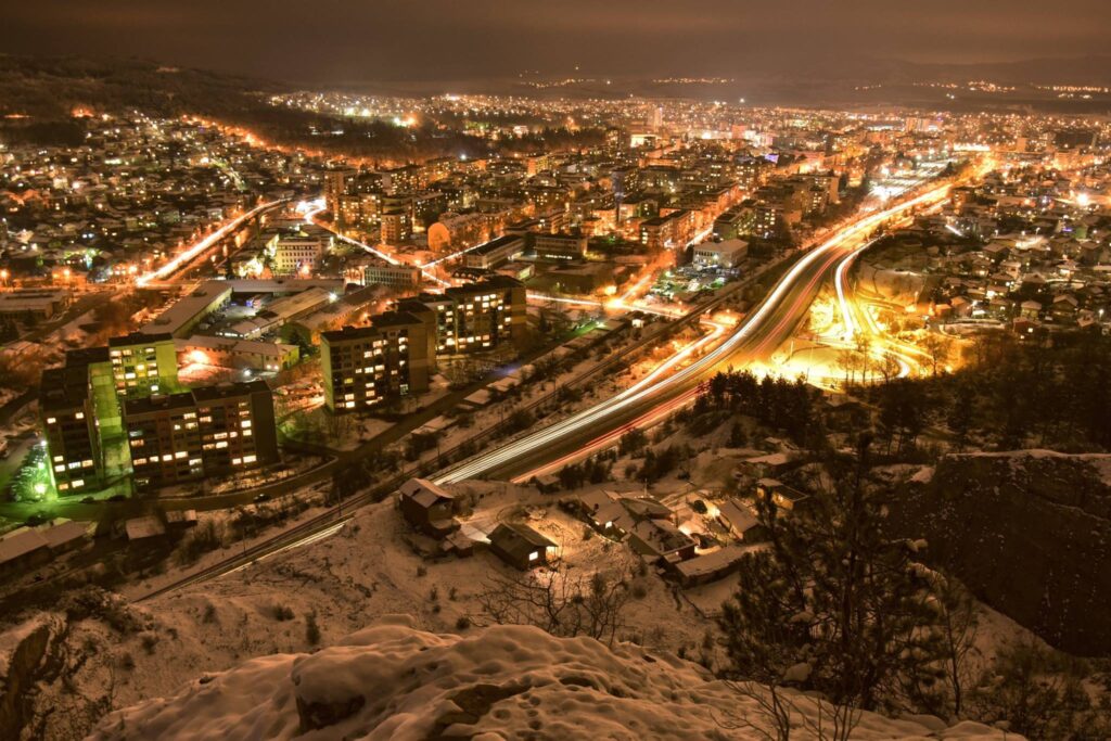
Pernik is a town in western Bulgaria (about 20 kilometres (12 miles) south-west of Sofia) with a population of 120,880 as of 2019. Pernik is the most populated town in western Bulgaria after Sofia. It is the main town of Pernik Province and lies on both banks of the Struma River in the Pernik Valley between the Golo Bardo Mountain, Vitosha Mountain, Lyulin and Viskyar mountains. Pernik is the principal town of Pernik Province – a province in western Bulgaria, which is next to the Serbian border.
Originally the site of a Thracian fortress founded in the 4th century BC, and later a Roman settlement, Pernik became part of the Bulgarian Empire in the early 9th century as an important fortress. The medieval town was a key Bulgarian stronghold during Bulgarian tsar Samuil‘s wars against the Byzantine Empire in the 11th century, when it was governed by the local noble Krakra of Pernik, withstanding Byzantine sieges a number of times.
From 1396 until 1878 the town was under Ottoman rule. In the 20th century Pernik developed rapidly as a centre for coal mining and heavy industry. During the Communist rule of Bulgaria it was called Dimitrovo between 1949 and 1962 after Bulgarian Communist leader Georgi Dimitrov.
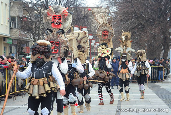
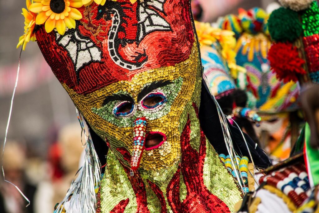
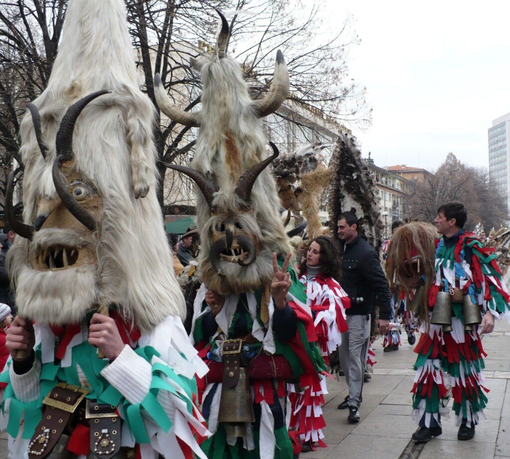
The Surva International Festival of the Masquerade Games (simply called Surva) is held in the town every January. Surva is an International Kukeri Festival in Pernik, Bulgaria and is one of the biggest masquerade festival on the Balkans and Eastern Europe. It is held in the last three days of January each year.
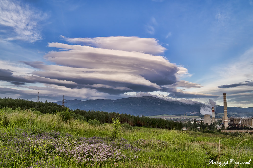
Economically Pernik is an industrial town. Industry is of vital importance for the economy of the province. Pernik is the major manufacturing centre, one of the largest in the country with the Stomana steel complex; heavy machinery (mining and industrial equipment); brown coals, building materials and textiles being the most important. Near Pernik there is an enormous plant for heavy machinery in smaller town Radomir which produces excavators and industrial equipment, but is currently not working at full capacity. Pernik has two football teams, PFC Minyor Pernik and FC Metalurg Pernik.
Name
The name Pernik is thought to have originated from that of Slavic god of thunder and lightning Perun or from a local boyar named Perin[1] + the Slavic placename suffix –nik (or –ik) added, and was first mentioned in the 9th century.
Location
Pernik is the second largest town in western Bulgaria. The town is located in the Pernik Valley. part of the ethnographic region of Graovo, at an altitude between 700 and 850 metres (2,297 and 2,789 feet), length of 22 kilometres (14 miles) and is surrounded by mountains Vitosha, Lyulin and Golo Bardo. Through the city flows the river Struma, which rises from Cherni Vrah – one of the largest rivers in the country with a total length of 2,290 over sea level. The total area is 28,863 acres (11,680 ha). Pernik is situated 30 kilometres (19 miles) southwest of the Bulgarian capital, Sofia. The territory of the town has many major roads, including Pan-European Corridor VIII and Pan-European Corridor IV – European route E79 /with Struma motorway and Lyulin motorway/, which connects Central Europe and Greece. Pernik has five railway stations and railway stops. The town lies close to one of the oldest trade routes in the Balkans, which ran from Sofia to Dubrovnik, via Skopje, Pristina, Sarajevo and Mostar.
Landmarks
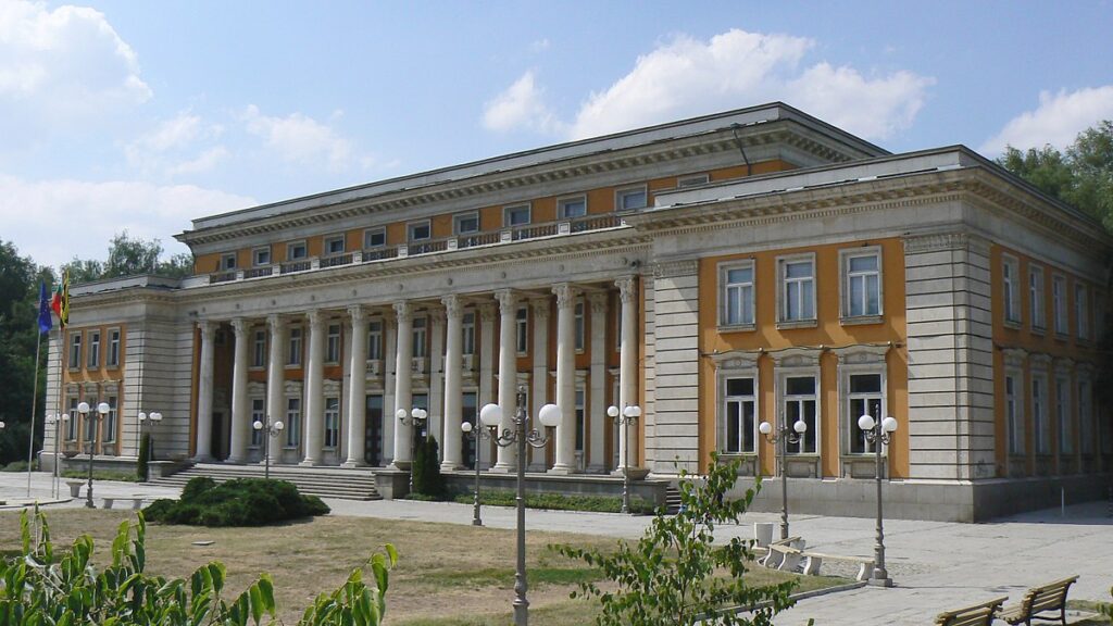
- Palace of Culture – Pernik – urban theater halls, orchestras, library, ensembles for folk songs and dances and more.
- Regional History Museum – Pernik
- Underground Mining Museum – Pernik
- Krakra‘s fortress – stronghold
- Duhlata cave – the longest in Bulgaria. Duhlata – with input from the southern slopes of Vitosha Mountain is the longest cave in Bulgaria (17,600 m.) and deep 53 meters. A complex multi labyrinth system located on 6 floors.
- Necropolis archaeological Thracian tribe Agrianes from 8th to 4th centuries BC – about 20 km south of Pernik to Struma motorway near the village of Dren. Necropolis was discovered in early 2012 during the excavation of the highway. Unique necropolis discovered in archaeological finds of gold Thracian treasure from breastplates, earrings, hairpins, jewelry and articles of silver and amber, which are stored in the Historical Museum of Pernik. Thracian sanctuary is included in the ranking “The Wonders of Bulgaria” 2013.
- Mountain Golo Bardo, immediately above city Pernik. Golo Bardo separating Pernik and Radomir valleys, in which the nature reserve “Ostritsa”.
- Holy water area – karst spring “Living Water” is near Vitosha village Bosnek. From his fountain of happiness, according to tradition of the 17th century, drank only the righteous, “but sinners refused.”
- Nature Reserve “Ostritsa” is located on the slopes of Mount Ostritza in Golo Bardo Mountain. It is among the oldest protected areas in Bulgaria.
- “Nightingale” hut in Golo Bardo, just above the city.The Church of St. Ivan of Rila
- Sacred pit of Garlo – is an archaeological site located near the village of Garlo in Pernik District.
- Lyulin Mountain to the north of Pernik. Come on the road to the villages Divotino and Liulin. Mountainside is located Divotinski Monastery “Holy Trinity”.
- Church of “St. John of Rila” – Pernik
- Church “St. George” – str. “Cherkovna”, district “Stoneware”
- Church “St. Prophet Elijah” – neighborhood “Moshino”
- Church “Saint Nicholas” – neighborhood “Church”
- Church “Assumption” /”Uspenie Bogorodichno”/ – neighborhood “Iztok” /”East”/
- Monastery “St. George the Conqueror” – neighborhood “White Water” /”Bela Voda”/
- Monastery “St. Petka” – neighborhood “Kalkas”
- Monastery “St. Panteleimon” – the area in the lung hospital in Golo Bardo mountain
- Church “St. Spas” – neighborhood “Varos” at the foot of the fortress area Obrochishte (ruins of an ancient temple)
- St. Peter & Pavel Monastery, Odranitza. (25 km north of Zemen)